Anglický čtenář v Doubravníku [11]
Pokud vás nedostal Oscar Wilde a nebo Shakespeare v minulých lekcích, nezoufejte.
- PhDr. Tomášek vytahuje další trumfy:
How to explore Doubravnik via satellite
Recently I have seen Doubravnik on the globe from the universe. I have seen also the places of catastrophe in USA. These images are rather simply accessible by the free program Word Wind. This program has been released by NASA as an open source program. World Wind is an application written in the language C# that allows the users to view many different global imagery sources in one place and projects that imager onto a globe that he can rotate and zoom in to see greater detail. More information you can find on the following site:
http://www.worldwindcentral.com/wiki/World_Wind_Users_Document
You can read there the download information as well as how to install this system on you computer. On the Internet, there is also a guide which helps you to start using this program.
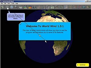
http://alteviltech.com/WorldWind/Tour/
Many users all over the word are exploring earth and teaching themselves geography by this wonderful tool. At its simplest version you can think of this program as a desk globe (it is a globe represented on your computer), however World Wind is not a simple desk globe, because it is provided wit many functions. There exists a large community of users distributed all over the world and you can take part in activities developed by these people. Exploring the word by the program World Wind gives the possibilities to visit and see and place on the Earth. Searching for Doubravnik I was lucky enough to find the village Husle not far from our Svratka valley. It is quite possible because the program World Wind allows any user to zoom from outer space into any place on Earth. You simply start with globe and using your mouse you can reach the desired destination. World Wind leverages satellite imagery and elevation data to allow users to experience Earth terrain in visually rich 3D, just as if they were really there. Virtually visit anyplace in the world.
Unlike your desk globe World Wind can display thousands of place names all over the world, from Country capitals to villages in sparsely populated regions. You can see country borders, and in some cases intracountry borders such as US states.
World Wind can also be expanded to include additional imagery and data. There have already been created a number of additional tools which are denominated add-ons (= dodatky).
World Wind offers the several built-in features and tools; most important of these tools are:
- Blue Marble - World Wind has a full copy of the Blue Marble, a spectacular true-color image of the entire Earth. Put together from data of a variety of satellites such as MODIS and Terra, the Blue Marble can be seen in all its glory at 1 km per pixel resolution.
- LandSat 7 - is a collection of images from 1999-2003 at an impressive 15 m per pixel resolution. LandSat 7's resolution makes it possible to see your own city, neighborhood, or landmarks in your vicinity. Seeing the whole globe like this puts the world in context with scientifically accurate data. You can view LandSat imagery in visible colors or in False Color bands.
- USGS - United States Geological Survey data. USGS provides Topography maps, 1-Meter detail images of most of the United States and Urban Area images of most of the major cities down to detail of .25 Meters.
- SRTM - Combining LandSat 7 imagery with Shuttle Radar Topography Mission (SRTM) Data, World Wind can display a dramatic view of the Earth at eye level. Users will literally be able to fly across the world in any direction.
On the following site:
http://worldwind.arc.nasa.gov/index.html
you can look for all the in formations you could be in the need of.
Being this text very simple to comprehend, I did not provide any vocabulary this time.
Good luck wit surfing!
. . .
rubriku vede: PhDr.Tomášek Pavel CSc.